 Highlights of Scotland
|
Much to my regret the profider that hosted my webpages for more than 25 years has announced that after 1 July 2026 they end the hosting service. Therefore all my web pages have been moved to another provider, which means the base URL changes from https://josvg.home.xs4all.nl/ to http://www.josvg.dds.nl/. The current page can now be found here. |
Highlights of Scotland
Click on the pictures for a larger version
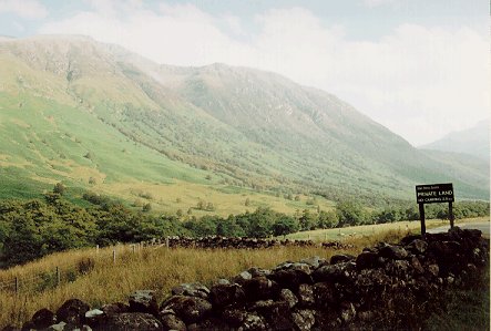
Ben Nevis, the highest mountain in the UK (1341 m), lies just north-east of
the road in Glen Nevis. The actual top of that mountain cannot be seen from
this road: the photo shows two somewhat lower 'sub-peaks' (or: 'bulges')
onn the south-west flank of the actual top, and they reach to about 900 m
(I think; it is difficult to see on the map); behind these two 'sub-peaks'
the mountain rises to its full height.
The road where the photo is taken from is perhaps 50 m above sea-level.

A rift in Ben Nevis, on the first photo near the top-left corner
(if I remeber correctly).
The name of this cleft is Five Finger Gully and it is a notorious
deathtrap on Ben Nevis [thanks to Bob Pert (rabpert@clara.net) for
this info].
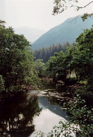
The river Nevis, somewhat further down the road into Glen Nevis.
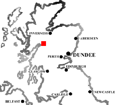 This map (17 kb)
shows with a red square where these three photos were taken;
dates: 15 September 1996.
This map (17 kb)
shows with a red square where these three photos were taken;
dates: 15 September 1996.
 Jos van Geffen --
Home |
Site Map |
Contact Me
Jos van Geffen --
Home |
Site Map |
Contact Me